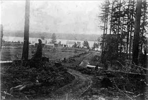
In September 1871, the Woodin family traverses Lake Washington aboard a scow loaded with their belongings to reach land they have claimed on the Squak Slough (later known as the Sammamish River) at the future site of Woodinville. The area around Lake Washington is then sparsely inhabited by Indians belonging to tribes that have ceded area lands to the United States and by a scattering of American settlers on isolated farms along the lakeshore. Paddles, oars, and poles will propel people and freight between far-flung settlements and Seattle until steamboats begin operating on the lake in the late 1870s. The hilly, timbered terrain surrounding the lake discourages cross-country travel, so American settlers follow the Indian custom of relying on water highways to travel in the region.
Scows and Canoes
The Woodins lived in the Rainier Valley southeast of downtown Seattle prior to their move to the Squak Slough. Ira Woodin (1833-1908) owned Seattle's first tannery, at Yesler Way and Third Avenue, with his father. However, as his wife Susan (1848-1919) would say almost 50 years later, "we decided to do a little more pioneering" (Baxter), and the couple filed a claim on 160 acres located along the slough. To reach the new farm, Susan remembered:
"We carted our things out to Laurelshade [now Madison Park] on Lake Washington over McGilvra's road, loaded them on a scow and then made the remainder of the voyage by water. There was not a steamboat on the lake, so we had to pole the scow or tow it from a rowboat. After we finally reached the head of Lake Washington we entered Squak Slough and worked our way along it to Woodinville. I do not know exactly how far it is from Madison Park to Woodinville by water, because in the old days the slough was awfully crooked. Mr. Woodin used to say that there was one place where he could touch one tree three times going less than a mile" (Baxter).
Scows, many of them more than 50 feet long and nearly 10 feet wide, were often used to carry large loads around the region's inland waterways. Some had three sets of oars to use in open water and poles for shallower water. Rowboats, some of which could carry two tons of freight themselves, also pulled the scows. Settlers frequently hired local Indian residents to carry passengers and cargo. Some of the Indian canoes, made of cedar logs, could carry several tons of freight.
Indians used both the Montlake Portage, a land route between Lake Washington and Lake Union just north of downtown Seattle, and the Duwamish and Black rivers south of the city, to travel between the interior waterways and Puget Sound. They also used the rivers and lakes to move seasonally between the coast and the interior and to hunt, fish, and gather resources. Trade routes and social networks also relied heavily on travel over regional water bodies, including Puget Sound.
Early settlers primarily used the river route because the isthmus between Lake Union and Lake Washington blocked the movement of large loads of logs, coal, or farm produce. This subjected the settlers to unpredictable water levels, caused by the tidal influence on the Duwamish, and ever-changing channels that meandered between sand bars and other shallow areas.
Even when settlers hired Indians who had more familiarity with the rivers to pole or row boats in their attempt to carry coal or lumber from the shores of Lake Washington and Lake Sammamish to Seattle's Elliott Bay waterfront, they still struggled to move the cargoes quickly enough to make the endeavors profitable. In the 1850s and 1860s it took up to five days to carry a load of coal from the southern tip of Lake Washington to Elliott Bay. It could take 10 days to carry coal from what would become Issaquah to the Seattle waterfront. Historian Lucile McDonald described a trip taken by scow to Squak (later Issaquah) in 1862:
"The scow, manned by Indians, required 20 days to make the round trip and traveled 140 miles. Part of the way it was poled over sand bars in the Duwamish by men walking from bow to stern as they pushed their poles in the soft mud" (The Lake Washington Story, 18).
To reach the Squak area, boats first had to travel the entire length of Lake Washington to the mouth of Squak Slough and follow the meandering route of the slough that connected the two lakes. They then floated down the length of Lake Sammamish to its southern end, ending up just on the other side of Cougar Mountain from where they started on Lake Washington.
Road Building
Eventually roads were built over the hills between Lake Washington and Elliott Bay. When John J. McGilvra (1827-1903) bought land in the area that would become the Madison Park neighborhood of Seattle, he built a road (now Madison Street) between his home, known as Laurelshade, and downtown. Farther south, an Indian trail over the hill became the road we know as Yesler Way. As more people established homesteads on the eastern shore of Lake Washington, the lakeside termini of these roads became landing places for farmers bringing their farm produce to market. Susan Woodin traveled by foot from her family's new farm to Juanita, paddled to the Madison Park landing, then followed Madison Street into the city to sell butter and to shop.
In the late 1870s steamships began operating on Lake Washington and Lake Sammamish, making travel faster and easier. As homesteading, logging, and coal mining increased, so did efforts to make use of the Montlake Portage, a much faster and more reliable route to Seattle.

