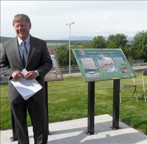
On June 5, 2013, about 50 people gather in Everett's Legion Park Overlook at 145 Alverson Boulevard to dedicate signs honoring the Native people who once inhabited the site and describing life in and around Hibulb Village, which stood for generations on the beach below the bluff where the signs are installed. Partners in the project, which is titled First Neighbors, include the Everett Northwest Neighborhood Association and Historic Everett, with grants from the Tulalip Tribes and the City of Everett Arts Commission. Three signs tell the story: "The Overlook: Eye of the Region," "Hibulb Village: Heart of the Region," and "The River: Lifeblood of the Region."
First Neighbors
High on a bluff on the northwestern tip of Everett, Legion Park Overlook offers a panoramic view of Port Gardner Bay, the Mukilteo and Everett shoreline, Gedney (Hat) Island, Whidbey Island, Camano Island, and the coastline that borders the Tulalip Reservation. Directly below Legion Park is the site of the Snohomish tribal village of Hibulb, abandoned after the Point Elliott Treaty of 1855 when its inhabitants were removed to the Tulalip Reservation.
The First Neighbors signage project began in January 2011 when Annie Lyman, a member of the Everett Northwest Neighborhood Association, suggested that the association find a way to visibly honor the Native people who lived for thousands of years in the area that is now the Everett Northwest neighborhood. Its current boundaries are the Snohomish River to the north, Port Gardner Bay to the west, Broadway Avenue to the east, and 19th Street to the south.
The neighborhood group agreed and approached Historic Everett, a nonprofit organization, to serve as consultant and fiscal sponsor of an interpretive-signage project. An organizing committee was formed, with Lyman as lead, Valerie Steel, J. T. Dray, Hugh Matheson, and Patti Lohse. The committee applied for and received $11,000 from the Tulalip Tribes and $2,000 from the Everett Arts Commission to create interpretive markers telling the story of the Snohomish people at Hibulb, nearby encampments and villages, and the river highway that connected them to inland locations.
The historical overseer of the project was Henry "Hank" Gobin (1942-2013), then director of the Tulalip's Hibulb Cultural Center. Other history consultants were Inez Bill, Mytyl Hernandez, Lita Sheldon, David Sienko, Marilyn Sheldon, Dr. John Mattson, David Dilgard, and Margaret Riddle. The committee selected Sedro Woolley artist James Engelhardt to design the signs, with additional artwork by Jocelyn Slack and photographs by John Lindstrom, Lloyd Weller, and Hugh Matheson. The Everett Parks Department became an important player in the project, facilitating installment of the signs and taking on the responsibility for their care.
The Overlook, the Village, and the River
Engelhardt and the design team created three signs:
"The Overlook: Eye of the Region" is an overview map of the coastline as seen from the bluff. Known early Indian villages and encampments are marked with their Lushootseed (Puget Sound Salish) names. A small map insert shows the same area with contemporary names. The promontory on which the signs are located "provided a sweeping view of the sea, bays, and river where campfires ... filled the night ... with twinkling lights" and, according to Gobin, led to the name remembered by elders as "Land of a Thousand Fires" ("The Overlook") An inset added for children tells the story of Gedney Island, which was known to the tribes as the "Land of the Little Ones," referring to the "wool dogs" (now extinct) that were raised on the island for their prized fur, used in making clothing and blankets.
"Hibulb Village: Heart of the Region" depicts the principal winter village of the Snohomish tribe. Located at the base of the bluff, below the sign's location, Hibulb was a fortified upper-class enclave comprised of several large longhouses and a major potlatch house surrounded by a cedar palisade. The marker's illustration is based on tribal lore passed down through elders and on archaeological evidence. Patkanim, a signer of the Point Elliott Treaty whose 1858 burial was the last at Hibulb, is also profiled. An inset, "The longhouse is the schoolhouse," tells young readers how children were taught within the family structure.
"The River: Lifeblood of the Region" is a tribute to the great importance of the Snohomish River to local tribes, which used it for transportation, food, and cultural exchange. Hibulb Village was located at the mouth of the river, where its inhabitants were gatekeepers, a powerful position from which to monitor traffic in both directions and allow those in the large village to easily connect with many other groups around the region. "Alliances were made, trades conducted, marriages arranged, and ceremonies set," with Hibulb as "the hub for business, diplomacy, and social gatherings" ("The River"). Here the Snohomish enjoyed a life of abundance, with ample sources of food and the materials needed to make canoes, houses, clothes, baskets, and other necessities of life. The children's inset, "Grandmother's Basket," explains the relationships between tribal children and the elders who instructed them in traditional lore.
Celebration
On dedication day, June 5, 2013, the weather was sunny with clear visibility, giving attendees a good view of the water, mountains, islands, and sky. Everett Mayor Ray Stephanson welcomed the gathered, and committee member Valerie Steel recognized and thanked the many project participants, remarking that "It took a village to honor a village" (Whitney, 2). Tulalip Tribal Leader Ray Fryberg Sr. spoke of the importance of this location to the Snohomish people and added that he felt that those who had lived here long ago were on this day looking down and smiling on the remembrance. Singers from Tulalip closed the program.
In 1974, archaeologist and Everett resident John Lyle Mattson, Ph.D., conducted a preliminary archaeological dig of the Hibulb (Hebolb) Village site, which yielded 930 artifacts, some of which are now housed at Tulalip's Hibulb Cultural Center (6410 23rd NE, Tulalip). Both the Hibulb Village location and a portion of Legion Park are recognized state archaeological sites.

