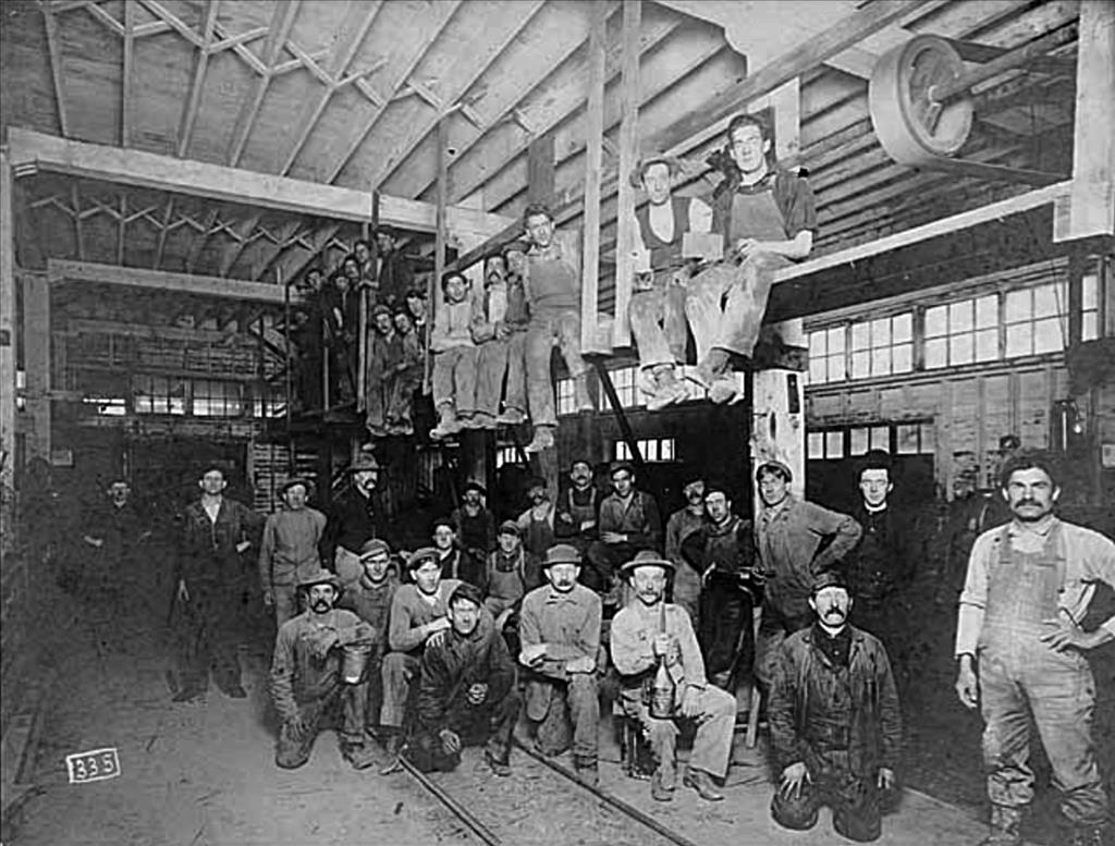
The mining of clay deposits in southeastern King County was big business from the late nineteenth century until the 1980s, when production slowed and mining sites were sold or repurposed. In this original essay for HistoryLink, Bill Kombol writes about the Blum clay pit, located north of Enumclaw, and how its refractory clay was used as lining in fireplaces, kilns, and blast furnaces in the Puget Sound region.
Coal and Clay
The Blum clay pit property was located just east of the Enumclaw-Franklin Road where Puget Sound Energy’s high-voltage lines now cross overhead. Technically, it lies in the SW quarter of the NW quarter of Section 31, Township 21 North, Range 7 East, W.M., in King County. This section, like many odd-numbered sections, was originally part of a land grant to the Northern Pacific Railroad for building the transcontinental railroad to Washington. The Northern Pacific, Oregon Improvement Company, and Black Diamond Coal Mining Company were early investors in coal fields of the Green River district, particularly in Black Diamond and Franklin.
In addition to their appetite for coal, the growing cities of the Puget Sound region needed clay, one of the prime ingredients for bricks used to pave streets and construct buildings. Locally, clay was first discovered in an area near Kummer by Jacob Sant in 1888, now part of Flaming Geyser State Park. The deposit and the town were named for George Kummer, a ceramist and engineer for the Denny Clay Company.
In 1905, two local companies joined forces to become the Denny-Renton Clay & Coal Company, which by 1917 was producing 58 million bricks per year. In 1927, California-based Gladding, McBean & Company bought out Denny-Renton and began a modernization program to address changes in the industry. By this time, paving bricks once popular for building roads were being replaced by less-expensive asphalt and concrete products.
In 1937, a high alumina clay deposit was discovered in Section 31 by Richard Farrow. He was owner of the Blue Blaze coal mine, a short-lived, tiny producing underground mine located on the Blum property or close nearby. Martin and Eleanor Blum purchased the property in the early 1900s, when Martin Blum was a partner in the Sutton-Blum Land Company. Their son, Thomas P. Blum, was a noted King County Bridge Inspector from 1924 to 1934. Through photographs, Thomas Blum documented many of the county’s bridges, including the nearby Kummer Bridge, which was constructed in 1932 and 1933. Martin and Eleanor's daughter, Katherine E. Blum, acquired ownership of the 41-acre tract in 1936 upon the death of her mother.
Federal Involvement During World War II
During World War II, many high-alumina clay deposits were explored by the U.S. Department of the Interior as possible sources for wartime use of aluminum. Beginning in October 1943, a joint investigation into the Blum clay deposit was carried out by the U.S. Geologic Survey and the Bureau of Mines. Three boreholes were drilled on the Blum property to obtain core samples for determining the clay’s chemical, specific gravity, moisture, lithologic, petrographic, x-ray, ceramic, and thermal properties. Studies of the Blum deposit revealed a clay bed varying in thickness from 6 to 13 feet. The clay seam was part of an anticlinal geologic structure, a term used to describe an 'ice-cream-cone' formation where clay layers slope downward in opposite directions from the crest or top of the cone. Robert Nichol’s Department of Interior report estimated that more than 1 million tons of high-alumina clay were present in the Blum deposit.
While the 1945 study by Nichols examined the potential of clay deposits as an ore for metallic alumina, its real value was realized a decade later as refractory clay. The Blum clay became an additive for making bricks able to withstand high temperatures, such as those used in kilns and fireplaces. A 1969 report by James Vine described the Blum ore as a "High-alumina flint clay; contains kaolinite and gibbsite; slacking; in part refractory."
The presence of this deposit was brought to the attention of Gladding, McBean & Co., operators of clay mines and brick plants up and down the West Coast. The property was acquired from the Blum family by Gladding, McBean in the mid-1950s. Full-scale exploration and development of the Blum clay deposit commenced in 1956.
Post-war Development
Initial contract mining of the deposit was conducted by Gordon Moulden Trucking of Buckley. In 1962, Gladding, McBean merged with the International Pipe & Ceramics Corporation, commonly known as Interpace Corp. Their plant was located in Renton, with clay transported from the Blum deposit by Moulden’s dump trucks. After Gordon’s death on February 14, 1972, his sons, Ron and Don Moulden, continued operations. Mining was conducted on an intermittent basis at two-year intervals into the mid-1980s.
Clay was excavated to a depth of 110 feet and the resulting pit backfilled with overburden and soil waste from the next mined section. A pond in the northeast section of the site was created as a result of historic mining. A 1971 photograph from Geological Bulletin 62 showed this mined-out portion of the Blum clay deposit with a caption noting that the property was being developed as a recreational site. Other mined areas were reclaimed in 1979 and planted with Douglas fir trees.
During the 1980’s, Interpace was acquired by North American Refractories Corporation, commonly known as NARCO. In 1987, NARCO retained real estate brokers to market their 41-acre property. Palmer Coking Coal Company purchased the site in 1989 for $62,000. Following acquisition, Palmer completed final reclamation work required by the State Department of Natural Resources and improved roads on the property. Palmer established two easements to the property in 1990, from both north and south. Portions of the site were logged in 1995 and replanted with Douglas fir seedlings, while other stands of timber were selectively thinned. Palmer enrolled the property in the Forest Land Designation program, then divided the site into two 20-acre lots.
Around 1999, representatives from the Cedar River Bowmen approached Palmer seeking recreational property for an archery range. Negotiations ensued and a 20-year lease was signed in March 2000. The Cedar River Bowmen adapted and improved the site for use as a full-range archery facility, utilizing site features to simulate game hunting with bow and arrow. The property was sold to EMF Enterprises in April 2017 and continues to be privately maintained by the Cedar River Bowmen for outdoor recreation.
