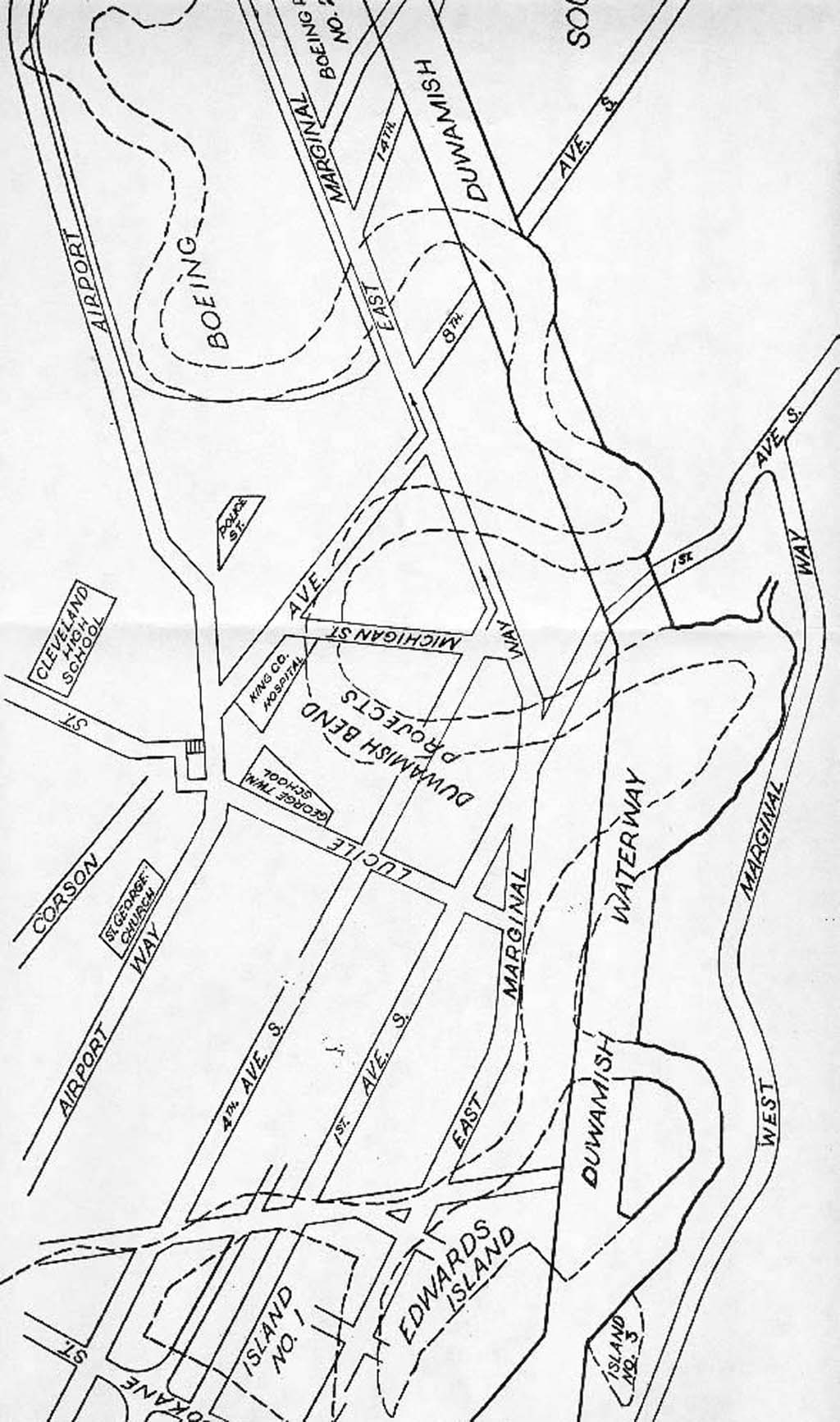
This is a map that shows the straight and deep Duwamish Waterway superimposed on the formerly meandering Duwamish River. The Duwamish River flowed through south Seattle into Elliott Bay. The straightening of the river began in October 1913. Map from Duwamish Diary by R. Foisy, 1949. Click on the map to view a larger version.
Duwamish Waterway map superimposed on a map of the formerly winding Duwamish River
- By HistoryLink Staff
- Posted 2/20/2001
- HistoryLink.org Essay 2993
Licensing: This essay is licensed under a Creative Commons license that encourages reproduction with attribution. Credit should be given to both HistoryLink.org and to the author, and sources must be included with any reproduction. Click the icon for more info. Please note that this Creative Commons license applies to text only, and not to images. For more information regarding individual photos or images, please contact the source noted in the image credit.
