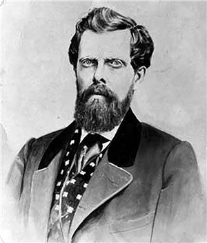
On May 1, 1852, Charles C. Terry (1829-1867) officially homesteads on Alki Point. Many decades later, on this site, a West Seattle business district known as the Alki starts operating at about the intersection of 63rd Avenue SW & Alki Avenue SW.
In September 1851, a reconnaissance party composed of Lee Terry (d. 1889), John Low (1820-1888), and David Denny (1832-1903) explored central Puget Sound seeking a place to settle. After exploring Elliott Bay and the Duwamish River, they chose the west point of the future West Seattle. Apparently John Low selected 320 acres south of Alki Point and Lee Terry selected 320 acres on the north side of Alki Point. John Low returned to Portland to inform the group that became known as the Denny Party the good news and to lead them to the Puget Sound settlement. Lee Terry and David Denny remained at Alki to secure the site and to build a cabin.
Shortly after the November 13, 1851, arrival of the Denny Party, Lee Terry and his brother Charles Terry opened a general store. By April 1852, Lee Terry had returned to New York, his place of birth. Charles Terry took over his brother's claim and continued operating the store and soon attracted other businesses to the point. For about two years, until Seattle became the center of business activity, this was the main village in King County. Eventually, Alki businesses closed and the land became farmland or lay fallow until the beginning of the twentieth century when the land was developed for residences.
Except for people arriving in Oregon and Washington territories prior to December 1855, land could not be homesteaded until it was surveyed. The U.S. General Land Office surveyed the Alki Point area on September 29, 1862. They described the point as nearly level with no timber or undergrowth for about one third of a mile. Apparently Alki Point was one of the first places on Puget Sound to be logged.

