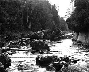
On November 24, 1959, the Green River crests near Kent, spilling water throughout the Green River Valley, and causing millions of dollars worth of damage. Hundreds are forced from their homes, and sections of roads and highways are swept away in the current. Also destroyed is a cofferdam at the construction site of Howard A. Hanson dam, upstream in the Cascade Mountains. Kent is located about 15 miles southeast of Seattle.
For years, floods in the Green and White River valleys were common occurrences, almost always happening in the months of November or December. It is during this time of year that a warm Chinook wind from the north is likely to melt heavy snowfall in the mountains and also to cause heavy rain.
In February 1959, work began on the construction of Howard A. Hanson Dam, located in Eagle Gorge, several miles to the east of the valley. This storage dam, when completed, would put an end to the almost annual flooding suffered by thousands of residents. The November 1959 flood wiped out a cofferdam at the construction site, but the dam was nevertheless completed ahead of schedule in 1962.
Folks in 1959 might have wished it was even sooner. As the November rains swelled the Green River, sandbags were placed in front of businesses, rowboats were readied for launch in front yards, and rescue workers prepared for the worst.
Down the River Road
The Green River crested at 4:00 p.m., November 24, when the water level reached 69.7 feet above sea level. (Flood level is attained at 65 feet.) Water surged throughout the valley, breaking through dikes and washing out sections of road. The worst washout occurred north of the City of Kent’s sewage treatment plant, where 200 feet of Russell Road broke off and was carried away by the current.
The Russell Road break created a channel for floodwaters to head west, threatening thousands of acres of farmland. Dairy farmers, by now used to the yearly routine, got their cattle to high ground. Riverfront homes bore the brunt of the damage. Some houses had two feet of water running through the ground floor.
The army rushed in amphibious trucks, known as “ducks,” a familiar emergency conveyance for valley residents, as well as two helicopters. Some cattle were up to their bellies in water and had to be flown out. Rearing ponds at the Soos Creek Fish Hatchery were flooded, and hundreds of thousands of fingerlings escaped.
Aftermath
After the flood, the water took weeks to dissipate. Damage costs were estimated at $1,557,500. King County was declared a disaster area and federal assistance was requested. The break in Russell Road was temporarily patched, but farmer Yasuo Narita, whose farm lay in the path of the water that poured through the break, was hit hard. “There’s huge deposits of sand which will have to be cleared away before we can ever farm here again.”
Dairy farmers through the valley suffered, and drops of 20 to 30 percent in milk production were seen over the next few months. Farmers who grew crops had problems of their own, many of them losing valuable topsoil, or gaining large amounts of silt and sand. Uprooted trees, fences, and wreckage filled fields throughout the valley.
In 1960 and 1964, King County voters, in response to the 1959 flood, approved two bond issues of $5 million each and created the River Management Program. The RMP waged an aggressive and wide-ranging flood control program throughout the 1960s and 1970s, until the bond funds were exhausted in the 1980s.
Work on the Howard A. Hanson dam was not completed until 1962, yet it prevented another potential flood on Christmas Day, 1961. Since its completion, major flooding of the valley has virtually ceased, making the 1959 flood the last big flood in the region.

