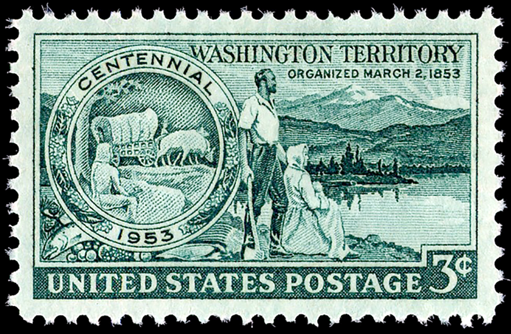
On March 2, 1853, U.S. President Millard Fillmore signs a bill creating the Territory of Washington out of the Territory of Oregon. The new territory's boundaries are: north, 49 degree North Latitude; south, approximately due east from the mouth of the Columbia River; east, the Rocky Mountains; west, the Pacific Ocean. The eastern part of the territory would later become part of the states of Idaho and Montana.
Movement for a separate territory started at a convention held August 29, 1851, at the Cowlitz Landing along the Cowlitz River, located south of Olympia near the future site of Toledo.
Attending the convention were 27 male citizens residing north of the Columbia River and west of the Cascades. The men drew up a memorial to the U.S. Congress seeking the creation of a new territory north of the Columbia River. The primary reason for establishing a new territory was the unreasonable distance to Oregon City, the Oregon Territory capital located in the Willamette Valley.
The memorial stated:
"the Inhabitants North of the Columbia River receive no benefit or convenience whatever from the Territorial Government of Oregon as now administered. They maintain positively that it costs more for a citizen in the North of Oregon Territory to travel to a clerk's office or to reach a District Judge than it does for a man to travel from S. Lewis [sic Louis], Missouri to Boston, Masachussetts [sic] and back." And that "[t]he Seat of Government at present is distant about three hundred miles from the principle Settlements North; The entire Legislative power is South of the Columbia River & from Locality and Geographical position the South has no interest in common whatever, with the North Government Officers but seldom if ever visit the North; under the present condition of things, the rights of Citizens must go unredressed [sic], crimes and injuries unpunished" (Meany, 7).
The memorial proposed "Columbia Territory" to include about 32,000 square miles of land using Columbia River as the territory's south and east boundary and the British [Canadian] line at 49 degree North Latitude as the north boundary.
An interesting sidelight to this convention is that proposals were made to create 11 counties in the new territory. At that time there were just three counties in the area north of the Columbia River -- Pacific, Lewis, and Clark. The boundaries of one of the proposed counties created out of Lewis County was described as follows: "From the mouth of the Sinhomas [Snohomish] River, [south] up the Sound to the northside of the Pugallup [Puyallup] River, thence due east to the Cascade Mountain."
Oregon Territory had no objection to the proposed territory and the memorial was given to Joseph Lane, Oregon Territory's non-voting delegate to the U.S. House of Representatives. Lane traveled to Washington D.C., and on December 6, 1852, the first day of the second session of the 32nd Congress, he introduced a resolution to create Columbia Territory. While the bill was under consideration by the House Committee on Territories, Lane received another memorial. On November 25, 1852, a convention of 44 residents of "North Oregon" met to reaffirm interest in a new territory.
On February 8, 1853, when House Resolution Number 348, to create Columbia Territory, passed out of committee and onto the House floor for debate, Oregon Delegate Lane presented the second memorial. During debate, Kentucky Representative Richard H. Stanton submitted an amendment to change the name of the territory to Washington to avoid confusion with the District of Columbia and to honor the "Father of the Country."
The House passed the bill by a vote of 128 to 29 on February 10, 1853, with the name change and an extension of the eastern boundary from the Columbia River to the Rocky Mountains, tripling the size of the territory to 100,000 square miles. The Senate concurred on March 2, 1853, and President Millard Fillmore signed the bill the same day.
News of Congress's affirmative vote reached Puget Sound nearly two months later, on April 25, 1853
