Island County, the eighth oldest county in Washington, was created on January 6, 1853, by the Oregon Territorial Legislature from a portion of Thurston County and was named for the myriad of islands in Northwestern Washington. It originally encompassed Snohomish, Skagit, Whatcom, and San Juan Counties. At present, Island County consists of just two large islands, Whidbey and Camano, and six small, uninhabited islands: Smith Island to the west, Deception and Pass islands in Deception Pass, and Ben Ure, Strawberry, and Baby islands in Saratoga Passage. The area that comprises Island County was first explored by Captain George Vancouver (1758-1798) during the spring of 1792. The county has a total area of 517 square miles; 208.4 square miles of land and 309 square miles of water. In area, it is the second smallest county in Washington. It is bounded on the north by Deception Pass, on the south by Puget Sound, on the east by Skagit Bay and Saratoga Passage, and on the west by Admiralty Inlet and the Strait of Juan de Fuca. According to the 2000 U.S. Census, Island County had a population of 71,558; 22,477 living in incorporated cities and towns and 49,081 living in unincorporated areas. The county seat is the historic town of Coupeville on Whidbey Island.
Coast Salish Communities
For thousands of years, the only occupants of the Pacific Northwest were Indians who lived in large communal longhouses subsisting on fish, shellfish, wild game as well as roots and berries. Whidbey and Camano Islands, as well as the San Juan Islands were occupied by several groups of Coast Salish Indians including Skagit, Snohomish, and a small number of Clallam. With the exception of periodic wars with other Indian tribes, life was relatively quiet for many centuries.
In the late 1700s and early 1800s the Indian population was decimated by disease transmitted through contact with European and American explorers. In some areas diphtheria, smallpox, and measles killed 90 percent of the Indians. By the time non-Indian settlers arrived, some local tribes had populations of only a few hundred and were so depleted they could not effectively resist the intruders.
Whidbey Island
Whidbey Island, which forms the western portion of Island County, was named on June 10, 1792, by Captain Vancouver for Joseph Whidbey (1755-1833), Master of the HMS Discovery, who proved it was an island by discovering Deception Pass. He was also the first documented non-Indian explorer to set foot on the island, landing at Penn’s Cove near what was to become Coupeville. The Indian inhabitants' name for the island was Tscha-kole-chy.
Whidbey Island, the largest island in Puget Sound, is approximately 45 miles long, 10 miles across at its widest point and one-and-a half miles at its narrowest. The island boasts five state parks, eight large lakes and 200 miles of shoreline. Narrow necks of land at Penn’s Cove and Holmes Harbor on Saratoga Passage divide the island into three distinct areas referred to as North, Central, and South Whidbey. State Route 20 connects Whidbey Island to the mainland west of Anacortes via the Deception Pass and Canoe Pass bridges and bisects Deception Pass State Park, a 4,134-acre marine and camping park encompassing the northern tip of Whidbey Island. The bridges were financed with funds from the federal Public Works Administration and the Washington Emergency Relief Administration, along with county funds, and were dedicated on July 31, 1935. The surrounding park was improved with Civilian Conservation Corps labor. The island is also served by two Washington State Ferry routes: Mukilteo-Clinton and Port Townsend-Coupeville (formerly named "Port Townsend-Keystone" for the unincorporated community on the west side of the island, some five miles from the city of Coupeville, where the terminal is located). According to the U.S. Census Bureau, in the year 2000, Whidbey Island had a population 58,211.
The first settler on Whidbey Island was Thomas W. Glasgow, a farmer, who filed a land claim on what was to become Ebey’s Prairie in 1848. Glasgow was married to Julia, the daughter of Patkanim, chief of the Snohomish Tribe. After filing his claim in Olympia, Glasgow and a friend, A. B. Rabbeson, returned to island and found approximately 8,000 Indians from several Pacific Northwest tribes encamped at Penn’s Cove. Julia said the Indians had gathered for a grand council to discuss the incursion of incoming settlers into their traditional hunting and fishing grounds. She suggested that Glasgow and Rabbeson leave because their lives were in danger. Later, Julia joined Glasgow in Olympia where they were formalized their marriage and raised a family. The Glasgows never returned to Whidbey Island.
Donation Land Act
On September 27, 1850, Congress passed the Oregon Donation Land Act, granting a "donation" of free land -- 320 acres to each single man and 640 acres to each married couple -- to anyone who had settled on the land before December 1 of that year. Colonel Isaac Neff Ebey (1818-1857) was the first man to file a claim, for 640 acres, in Central Whidbey Island, on October 15, 1850. The land, on the west shore immediately south of Penn’s Cove, has been memorialized in history as Ebey’s Landing and Ebey’s Prairie. Several other settlers, mostly family and friends, filed for claims in the area shortly thereafter.
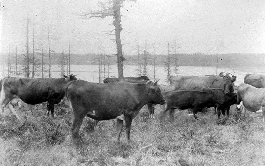
They converted the rich black loam of the prairies into farms, planting wheat, oats, and potatoes, and some raised sheep. The settlers also engaged in logging. Oak trees were sold for ship decks and planking, and the tall, straight Douglas-firs for masts and spars. Coveland, a small settlement at the head of Penn’s Cove, served as the Island County seat (1853-1881) and provided the island’s first trading post, opened by Captain Benjamin Barstow in 1853. In 1888, a group of land developers platted Coveland and changed the name to San de Fuca, chosen because of its proximity to the Straits of Juan de Fuca.
Isaac Ebey
Colonel Ebey was active in politics and held several public posts. In 1852, he served as a representative from Thurston County in the Oregon Territory Legislative Assembly and was instrumental in the formation of Island, Jefferson, Pierce, and King counties. In 1853, Ebey was appointed as Island County’s first Justice of the Peace and also served as a probate judge. This same year, President Franklin Pierce (1804-1869) appointed Ebey as Collector of Customs for the Puget Sound District. Ebey promptly moved the Customs House from Olympia to Port Townsend. During the Indian Wars (1855-1856), he commanded a company of Washington Territorial Volunteers.
On August 11, 1857, Ebey was shot and beheaded at his Whidbey Island home by a band of Haida Indians who believed he was a Tyee or chief of the new settlers. The killing was to avenge the death of a Tyee and 27 Indians killed at Port Gamble in November 1856 during a battle with the USS Massachusetts.
Coupeville
Coupeville, located on the south shore of Penn’s Cove, is the oldest town on Whidbey Island and in Island County. It was founded by Thomas Coupe (1818-1875) captain of the bark Success, who arrived in Puget Sound in 1852 and filed a 320-acre donation land claim on the site. Captain Coupe is the only man known to have sailed a square-rigged sailing ship through treacherous Deception Pass.
The town was established in the early 1850s after several sea captains who had been plying the waters of Puget Sound decided to retire there, filing donation land claims. Coupeville, perfectly situated in Central Whidbey Island across from burgeoning Port Townsend, prospered and grew. The town replaced Coveland as the county seat in 1881 and was incorporated in late April, 1910. The Indian name for Coupeville was reported to be P't-sa-tl-y, meaning "snake basket." According to the 2000 U.S. Census, Coupeville had a population of 1,723.
Fort Ebey and Fort Casey
Immediately west of Coupeville, on Pigeon Point, is Fort Ebey, built by the Harbor Defense Command during World War II (1941-1945) to help protect military bases around Puget Sound. Along with gun emplacements, it was also an important radar site. This property was acquired by the state in 1968 and became Fort Ebey State Park, a 645-acre campground with three miles of saltwater shoreline, in 1981.
Four miles south of Coupeville, on Admiralty Head, is Fort Casey, built by the U.S. Army at the turn of the twentieth century. Activated in 1901, this imposing fortification was one of three major Coast Artillery forts built to protect Puget Sound from invasion by sea. Along with Fort Flagler on Marrowstone Island, and Fort Worden at Point Wilson, the three forts formed a “Triangle of Fire” that would destroy any enemy vessel attempting to enter Admiralty Inlet. Together, these fortifications constituted the heart of the Harbor Defenses of Puget Sound. Fort Casey is also home to the beautiful Admiralty Head Lighthouse, built in 1903.
The Department of Defense deactivated Fort Casey in 1953 and transferred the property to General Services Administration for disposal. In 1955, Washington State Parks and Recreation Commission acquired 100 acres of Fort Casey’s battery area for use as a state park and historical monument. Seattle Pacific University purchased 87 acres, which included most of the fort’s administrative buildings and housing, to create the Camp Casey Conference Center. The present Fort Casey State Park, which includes the Keystone Spit area, was acquired between 1955 and 1988 in three parcels, at a total cost of $300,000.
On December 12, 1973, the National Park Service listed Central Whidbey Island (also known as Ebey’s Landing National Historic Reserve) on the National Register as a Historic District (listing No. 73001869). The Washington State Advisory Council on Historic Preservation also listed the district on the Washington Heritage Register (listing No. 004). In 1980, Fort Ebey and Fort Casey State Parks, including the Admiralty Head Lighthouse, were incorporated into the listings. Today, the Central Whidbey Island Historic District, stretching roughly six miles on either side of Coupeville, and encompassing approximately 25 square miles, is one of the largest historic districts in the country, and has more than 100 structures listed on the National Register of Historic Places.
Oak Harbor
Oak Harbor is located on the east shore of North Whidbey Island, about 10 miles north of Coupeville. It was named by Dr. Richard H. Landsdale, an early settler on Penn’s Cove, for the many large oak trees (including Garry oaks) in the vicinity, an unusual feature in this part of the state. The Indian name for the Oak Harbor/Crescent Harbor area was Kla-tole-tsche. The settlement was founded by three veterans of the California Gold Rush: Zakarias Martin Taftezon (1821-1901), Ulrich Freund, and Clement W. "Charlie" Sumner They came from Olympia by Indian canoe, looking for land. They landed on the western shore of Crescent Harbor and, after seeing the empty fertile prairie, returned to Olympia, filing Donation Land Claims on January 4, 1851.
In the 1850s, Irish immigrants began to settle in the Oak Harbor area, followed by Dutch immigrants in the 1890s. The town of Oak Harbor was officially incorporated on May 14, 1915. In July 1920, the “Oak Harbor Fire” destroyed much of the town. The town struggled through the Great Depression (1929-1939) until 1941 when the U.S. Navy arrived to build an air base. Suddenly Oak Harbor, a quiet farming community of some 650 inhabitants, was transformed into a boomtown as thousands of construction workers and naval personnel arrived in the area. The number of active duty military personnel in Island County, excluding dependents, stays relatively constant, at about 6,000 to 7,000. According to the 2000 U.S. Census, Oak Harbor, the largest city in Island County, had a population of 19,795.
North Whidbey Island was essentially a rural, agricultural community until January 17, 1941, when the U.S. Navy decided to build a seaplane base for rearming and refueling navy PBY Catalinas in defense of Puget Sound. The commander of Naval Air Station Sand Point in Seattle recommended Crescent Harbor and Forbes Point on the shores of Saratoga Passage as suitable for seaplane takeoffs and landings under instrument conditions. The site, near the town of Oak Harbor, was protected, the weather was usually good, and it was seldom foggy.
In November 1941, the navy also decided to build an airport for land-based airplanes. The topographic survey team chose Clover Valley, approximately four miles north of Oak Harbor. It was tailor-made for a landing field: level, well drained, and accessible from any approach. The area was strategically located to guard the Strait of Juan de Fuca and the entrance to Puget Sound. Also, the population was sparse, allowing the base plenty of room to grow.
After the December 7, 1941, attack on Pearl Harbor, work on the naval bases began in earnest and concluded in record time. The actual construction of the field began on March 1, 1942, and the first plane, a single-engine SNJ trainer, piloted by Lieutenant Newton Wakefield, landed there on August 5, 1942. Naval Air Station Whidbey Island was commissioned on September 21, 1942. A year later, on September 25, 1943, the airfield was named Ault Field, in memory of Commander William B. Ault, missing in action in the Battle of the Coral Sea. According to the 2000 U.S. Census, Ault Field had a population of 2,064.
Freeland
Freeland is located at the head of Holmes Harbor in South Whidbey Island, 17 south of Coupeville. The site was platted in the 1800s by real estate promoters who called it St. Louis, but no town resulted. At one brief period the area was called Newell, which was the name of the nearest post office. The town was named for the Free Land Association, a group of socialists from South Dakota who intended to make land available to its members practically free of cost, paid for through cooperative enterprises. On January 12, 1899, George Washington Daniels, Henry L. Stevens, and Henry A. White formed the Free Land Association, and on December 29, 1900, Daniels platted a town made up of five-acre lots. It was intended that all the members of Freeland work for the common good, but the settlement failed to coalesce as a socialist community and the Free Land Association went bankrupt in 1920. According to the U.S. Census Bureau, in the year 2000, Freeland had a population 1,313.
Perhaps, the most interesting event involving Freeland in the early days was a proposal to build a canal one-and-a-half-miles across South Whidbey Island. In the early 1900s, a venture capital group known as The Pennsylvania Syndicate, took options on nearly ten thousand acres of land between Holmes Harbor and Mutiny Bay on Admiralty Inlet. Their plan was to construct parallel train tracks and a sea-level, salt-water canal to allow ships and barges to be towed between Saratoga Passage and Admiralty Inlet, saving a trip around Possession Point. But anyone familiar with the area knew the savings in time and effort would be negligible and the project was abandoned.
Langley and Clinton
Langley is a small town on Saratoga Passage, approximately 10 miles east of Freeland on South Whidbey Island. The town was platted by Jacob Anthes in 1890 and named for Judge James Weston Langley (1836-1915), a partner in the Langley Land and Improvement Company. A post office was established in 1891 with Anthes as postmaster. Langley, which called itself “The Hub of the Island,” incorporated on February 26, 1913. The town supplied the outlying farmers with mail and dry goods, and was the terminus of steamer Camano, which sailed to Everett and Seattle.
In the 1900s South Whidbey Island was a popular summer destination and many of the Langley homes took in summer boarders. Logging and agriculture -- primarily truck gardens, fruits and berries -- were South Whidbey Island’s principal industries. A large commercial cannery was built at Langley that supplied the Puget Sound region with canned fruits and vegetables. The Island County Fair, established in 1924, is held in Langley every August. According to the 2000 U.S. Census, Langley had a population of 959.
Clinton, another small town, is located on a high bluff overlooking Saratoga Passage, approximately six miles south of Langley. It was named for Clinton County, Michigan, by Edward C. Hinman, a Civil War veteran, who came from there in 1883, filing a timber claim. He built a hotel and a dock, supplying steamships with wood and water. The original landing and nearby post office was called Phinney, after John G. Phinney, an early settler. In 1885, the post office was moved to the Clinton Union Store and, in 1892, renamed the Clinton Post Office. Edward Hinman served as postmaster from 1885 to 1896 and his brother, Henry, from 1898 to 1903. Like other small communities in the area, Clinton’s economy depended primarily on logging, fishing, and farming. In the 1900s, touring became popular and the community received its fair share of tourists, campers, and summer dwellers. Because of the easy ferry commute between Clinton and Mukilteo, South Whidbey Island has become a minor bedroom community for Seattle and Everett, where the Boeing aircraft assembly plant is located. According to the U.S. Census Bureau, in the year 2000, Clinton had a population 868.
Camano Island
Camano Island lies between Whidbey Island and the mainland of Snohomish County. The island, approximately 18 miles long, seven miles across at its widest point and less than one mile at its narrowest, has a total area of 39.8 square miles. It is connected to the mainland, two miles west of Stanwood, by the Mark C. Clark Memorial Bridge (State Route 532) across West Pass and Davis Slough, which is dry at low tides. Mark C. Clark (1896-1984) was a commanding general in the U.S. Army during World War II (1941-1945) and the Korean War (1950-1953). He had property on Camano Island and was there with his wife in the late 1940s when the bridge was being planned.
The earliest inhabitants of Camano Island were the Kikalos and Snohomish Indians who used the island during the summer while gathering seafood and berries. Their name for the island was reported as Kal-lut-chin, meaning "land jutting into a bay." The island was charted in 1841 by the Wilkes expedition as "McDonough’s Island” in honor of Master Commandant Thomas McDonough, captain of the USS Saratoga during the War of 1812. In 1847, Captain Kellett of the British Navy, in his effort to restore Spanish names to the area, renamed it Camano Island in honor of Spanish explorer Lieutenant Don Jacinto Camano. In the 1855 Point Elliott Treaty with 22 Puget Sound Indian tribes, Washington Territorial Governor Isaac Ingalls Stevens (1818-1862) referred to the island as Perry Island and local loggers, for no particular reason, called it Crow Island. But eventually the name Camano came into common use.
The first settlers came to Camano Island in 1855, filing timber claims. The island was densely forested with stands of tall, straight Douglas-firs perfect for masts and spars. Utsalady, on Utsalady Bay at the northern tip of the island, was the site of a shipyard and one of the largest sawmills on Puget Sound, founded in 1858 by Whidbey Island pioneers Thomas Cranney and Lawrence Grennan. "Utsalady" was a distortion of an Indian word also rendered as "Uts-ollaie," and said to mean "place of berries." After Grennan died in 1869, Cranney operated the mill alone until 1876, then sold it to Pope and Talbot’s Puget Mill Company. When a depression hit the United States in 1890, market gluts and poor prices caused the sawmill to close. The machinery was moved to Pope and Talbot’s mills at Port Gamble and Port Ludlow. Later farmers came and removed the stumps and developed the island agriculturally.
There were no towns on Camano Island, but steamboats serviced the small communities of Camano City and Mabana. A horse-drawn ferry operated between the island and Stanwood until a bridge was built in 1909. In the 1920s, tourism became popular and several auto-camps were established, followed by more elaborate resorts that rented cabins, boats, and fishing gear. In 1949, Washington State Parks and Recreation developed 134 acres of land on the west side of Camano Island, overlooking Saratoga Passage, for use as a state park. Today (2005) Camano Island is entirely a farming and residential community, well-known for its production of fruits and berries. According to the U.S. Census Bureau, in the year 2000, Camano Island had a population 13,347.
Steamers and Car Ferries
In the early years, sailing ships and small steamers serviced Whidbey Island haphazardly. In 1906, Coupeville resident Captain Howard B. Lovejoy purchased the sternwheeler Fairhaven and ran on a schedule between Penn’s Cove and Seattle with stops at points on South Whidbey Island. In 1911, Lovejoy founded the Island Transportation Company, adding the steamers Atlanta, Clatawa, Calista, and Camano, and the community of Port Townsend to the scheduled service. Lovejoy’s company merged with the Sound Ferry Line, becoming the Whidbey Island Transportation Company.
Car ferries entered the picture in 1919, with the growing popularity of automobile touring. The first ferry in Island County especially designed to carry automobiles was the Whidbey I, operated by the Central Ferry Company between Clinton and Mukilteo. Then the car ferry Central I, was added, running between Clinton and Everett. The Whidbey Island Transportation Company soon entered into direct competition, running car ferries between Langley, Clinton, and Everett. In 1927, the Puget Sound Navigation Company, doing business as the Black Ball Line, bought out all the minor steamship companies servicing Island County, establishing its own routes and schedules. The Black Ball Line operated ferry service until 1951, when it was purchased by Washington State Ferries.
Island Economy
Today (2005) nearly 88 percent of all economic activity in Island County is directly and indirectly linked to the navy’s presence, which includes employment, payrolls, retiree pensions, health care, and purchases of goods and services from local vendors. The base employs more than 10,000 workers, constituting 68 percent of Island County’s total employment. The annual payroll earned by military and civilian workers is $399.1 million, constituting 52 percent of the county’s labor earnings. In addition, the school districts in Island County receive $4.5 million annually as compensation for schooling the dependents of service personnel.
Other important economic activities in the county are farming, fishing, tourism, real estate, and construction, which accounts for the largest percentage of retail sales. Buying property and building vacation homes on the islands has become exceedingly popular. According to the U.S. Census Bureau, between 1900 and 2000, Island County’s population grew from 1,870 to 71,558, an increase of 97.3 percent. Between 2000 and 2004, the county’s population increased 10.8 percent, to 79,293, a trend in growth predicted to continue. Many retired and self-employed people move to the county, attracted by the mild weather, beautiful scenery, recreational opportunities, rural settings, and a lower cost-of-living.
