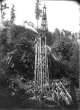
On August 5, 1914, nearly half a century after its conception, the road connecting Mukilteo and Everett is opened officially and with grand ceremony. Hundreds of Everett and Snohomish County residents make the pilgrimage to Mukilteo to celebrate the event. Fifty cars form a cavalcade of visitors. They are met by county pioneers including Alexander Spithill (1824-1920), Louisa Fowler Sinclair (1862-1955), and Snohomish County historian William Whitfield (1846-1940). Many greet each other for the first time in years. Guests hear speeches by early residents, tour the Mukilteo lighthouse and are treated to a meal of roasted clams, green corn, and potatoes.
A Big Event
Building a road along the coast line from Everett to Mukilteo was difficult from the start due to the many hills and valleys, a winding shoreline, and the need to span seven steep gullies. Travel between the two cities had, up until this time, been made by water and rail. Such a road had been talked about since the county’s formation in 1861 and by the early 1900s, appropriations were made to start construction. About 1913 the road had reached as far as Pigeon Creek No. 2, near present-day Forest Park.
Celebration of the road’s completion on August 5, 1914 was a big event. Visitors came to Mukilteo by boat, rail and car. Old settlers were invited to speak. Eldest was pioneer Alexander Spithill who at 90 years of age reminisced about early Mukilteo. Spithill had homesteaded the land that eventually became known as “Japanese Gulch.” Historian William Whitfield entertained the crowd with local history. In 1926, William Whitfield would edit and publish his two-volume History of Snohomish County Washington.
Politicians running for office passed out campaign cards and posted placards. The Everett Morning Tribune reported seeing two women candidates running for the same office on the same ticket helping each other hang their signs side by side.
Four thousand pounds of clams as well as bushels of potatoes and green corn were skillfully prepared by Mukilteo longshoreman and offered in a generous clambake. Lighthouse keeper P. M. Christiansen gave tours of the lighthouse, explaining the workings of the kerosene engines that operated the foghorn and allowing visitors to climb the winding stairs to the chamber that held the revolving light.
Boulevard Development
On opening day, the road was already being referred to as a boulevard, due to its winding nature. By the 1920s the name Mukilteo Boulevard appears on maps. Opening of the road allowed residential development in a corridor that is now upscale view property. The earliest homes that still survive along this route date from the late 1920s. Works projects during the Great Depression included tree planting and concrete retention walls that line the boulevard at Everett’s Forest Park. A postwar building boom of the 1940s and 1950s added more homes along the way and began a residential development at View Ridge near Forest Park.
Early bridges have been replaced with modern ones, some gullies have been filled, and the road has been widened, paved, and repaved over the years. Yet Mukilteo Boulevard has kept its charm as it winds through Forest Park and borders Howarth Park and Harborview Park, the latter providing a sweeping panoramic view of Everett and the Olympic Mountains. Below Harborview Park is the site of Jacob Livingston (1837-1916) and David Livingston’s (1830-1913) plat of "Western New York," filed in 1872, a development that never materialized. This was the site of Snohomish County’s first steam-powered sawmill in 1863. An adjoining residential development still carries the street names platted by the Livingston brothers.

