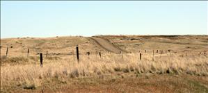
During the summer of 1859, Gustavus Sohon (1825-1903), a member of Captain John Mullan's team, explores the plains of Eastern Washington and the foothills of the Bitterroot Mountains in search of a viable route across the mountains for a military wagon road. He finds that the tribes of Eastern Washington Territory are reluctant to share information about the countryside for fear that the road will bisect their homeland and bring an influx of traffic and settlements. Sohon arrived on the Columbia River in 1852 as a private in the U.S. Army, and during the following decade, accompanied four expeditions across Eastern Washington. A man of many talents, he serves as a guide, an interpreter, an explorer, and a cartographer, but he is best known as a self-taught artist whose surviving pencil sketches and watercolors of important figures and landmarks comprise valuable eyewitness records of a crucial transitional period in Inland Northwest history.
Road Required
In the spring of 1859, the U.S. War Department appropriated funds for the construction of a military wagon road between Fort Walla Walla, Washington, and Fort Benton on the Missouri River, under the command of Lieutenant John Mullan (1830-1909). In mid-May, Mullan arrived at Fort Dalles on the Columbia River and immediately began organizing a crew. During the past five years he had been assisted in various surveys by an enterprising artist named Gustavus Sohon, who was also adept with meteorological and surveying instruments.
Mullan lost no time in assigning Sohon to explore a potential crossing of the Bitterroot Mountains to see if it would be passable for wagons. "Mr. Sohon’s early connexion with my explorations in 1853 and 1854, his knowledge of the Indian language, his familiarity with the general scope of country to be traversed, and the influence he had always so beneficially exerted over the Indians, all pointed him out as the proper person to explore the new and dangerous region" (Mullan, 11).
Sohon's Journey
Sohon made the familiar journey to Fort Walla Walla, where he attempted to hire Nez Perce guides, “but when I mentioned to them the particular route that I wished to examine, they represented to me that the whole region was one immense bed of rugged mountains, and over which they never heard of any persons having traveled, and therefore they declined to join my party” (Mullan, 95).
Sohon succeeded in hiring a Palus chief named Slougharchy, and with two assistants trekked north to the Snake River, then worked his way up the Palouse drainage. The only known journal in Sohon’s hand is the one that he kept on this journey, which is filled with charts denoting the weather, his line and distance of travel, and sketch maps of creeks and landmarks along the way, denoted by their tribal names. He noted the presence of forage and water for pack animals, good camp sites, fords, and possible routes for a wagon road.
On June 20 he reached a large prairie where a band of Coeur d’Alene Indians were digging camas; here he had planned to meet a guide named Augustine to show him a pass through the mountains. “During the day the chiefs and principal men, who had been my old friends, visited me in camp and exchanged news ... . They were evidently excited regarding the construction of the military wagon road, and inquired anxiously concerning its probable location ... . I saw then, from the mood of the Indians, that their services could not willingly be secured” (Mullan 98). Sohon did succeed in convincing Augustine to guide him a short distance into the foothills, but after two days, his guide refused to travel any further, announcing that “If all the Americans would work here a thousand years they could never make a road. I think a road through the Pend Oreille country is the best for you” (Mullan, 99).

