The Cedar-Sammamish Watershed in King County comprises 692 square miles of mountains and valleys that have been shaped by environmental forces and by generations of human activities. The watershed, in turn, has shaped the communities along its rivers. As the place we know today came into being, the ancestors of Coast Salish people developed a wide range of practices to create a greater abundance of resources, a deep knowledge of place, far-reaching trade and social networks, and stable, sustainable communities. When non-Native settlers arrived in the 1860s, they brought their own value systems and relationships to the watershed and significantly altered it. Navigation and flood-control projects, such as the Lake Washington Ship Canal, led to the reworking of the watershed's hydrology. This resulted in the loss of the lake's outlet to the Duwamish Watershed via the Black River, the routing of the Cedar River into the lake, and the joining of Lake Union with the watershed. Since the 1800s the watershed has been in transition as people living here have altered the environment, adapted to changing circumstances, and developed strategies for sustaining its natural resources.
An Ancient Landscape
Today two rivers empty into Lake Washington, their waters flowing out to Puget Sound via the Lake Washington Ship Canal. The Cedar River's 45-mile journey begins in the Cascades by Abiel Peak, and since its rerouting in 1911 it flows into the southern end of Lake Washington. Creeks, such as May Creek and Ravenna Creek, drain the land around the lake and Mercer Island. The Sammamish sub-basin, which lies to the east, is also fed by creeks, and drains into Lake Washington's northern end via the Sammamish River. The lake drains out to the sea through the Lake Washington Ship Canal, which joined Lake Union and Salmon Bay to the watershed in 1916.
This reworking of the watershed's hydrology fundamentally altered a landscape that was created by millions of years of interacting tectonic and glacial processes. Colliding plates forced up the Cascade Mountains and volcanic flows laid down layers of rock. The Cascadia Subduction Zone feeds the many active volcanoes and the Puget lowland is crisscrossed with surface faults. Between 18,000 and 16,000 years ago, the 3,300-foot-thick Puget Lobe of the Cordilleran Glacier flowed across the lowland and sculpted the troughs now occupied by Puget Sound and its rivers, including parts of the Cedar-Sammamish Watershed. The glacier blocked drainage to the north and created large glacial lakes, which drained south as the ice melted. As it retreated to about the location of today's Woodinville, the water flowing from the glacier created the troughs for Lake Washington and Lake Sammamish before draining out to the Pacific Ocean via Grays Harbor.
The glacier retreated past the entrance to the Strait of Juan de Fuca about 14,900 years ago, and up until about 13,500 years ago Lake Washington and Puget Sound were connected by salt water. Lake Washington became isolated as a freshwater lake when sediment deposited by the Cedar River built up an alluvial fan at the lake's southern end, near present-day Tukwila. The level of the lake continued to rise as the Cedar's alluvial fan kept pace with a rising sea level in the Duwamish River Valley. Saltwater stretched uninterrupted between Elliott Bay and Commencement Bay until repeated lahars (volcanic mudflows) from Tahoma/Mt Rainier and ongoing deposition from rivers filled in the Duwamish River Valley to Elliott Bay.
Lake Sammamish drained into Lake Washington through a slough, and a melting piece of glacier formed Lake Union. Cedar Lake (later renamed Chester Morse Lake) was the uppermost major lake in the watershed, formed when glacial debris pushed up from the Puget Lobe blocked the mouth of the valley that was previously carved by another glacier. Bull trout and pygmy whitefish in the lake have been separated from the surrounding watershed for 13,000 years by the natural barrier of Cedar Falls.
Earthquakes and Other Upsets
Seismic activity also has had a profound influence on the landscape and cultures in the Cedar-Sammamish Watershed. The Seattle Fault runs through the southern portion of Lake Sammamish, across Lake Washington, and as far west as Hood Canal. The Seattle Fault Zone is made up of closely spaced parallel faults, or strands, each crossing through Mercer Island. The last big event on the fault was approximately 1,100 years ago. It lifted the ground about 20 feet , leaving a fault scarp across Seward Park and causing massive landslides, including whole hillsides of old-growth forests that slid off Mercer Island into Lake Washington. The earthquake displaced enough water northwards to generate a tsunami that deposited 15 inches of sand at Kenmore.
Without written records or even archaeological evidence from the post-glacial period, it is hard to recreate the human history of that era. Stories told by Coast Salish people today provide a window into the very distant past, when communities were just getting established. An important aspect of these stories is the way they are tied to distinct landforms that record the geological history of the region. Lushootseed names and stories for places on Mercer Island, Seward Park, and Rainier Beach relate to events on the Seattle fault. The events experienced over the millennia by Coast Salish people living along the Cascadia Subduction Zone and the Seattle Fault Zone are recorded in epic stories in which the supernatural is associated with extraordinary natural events, such as earthquakes, landslides, and tsunamis. It is for this reason that there were no Salish settlements on Mercer Island.
Ice Retreats, Life Returns
The receding ice left behind a cold, steppe-tundra landscape where little grew but the bushy plants eaten by the mastodons, giant sloths, and bison that roamed there. Over time, vegetation changed with changing climate conditions and developing nutrient cycles. About 13,000 years ago, a forest of hardy lodgepole and white pine took root in the sandy soil. True firs and spruces followed, and by 10,000 years ago, as the climate warmed, Douglas fir and red alder arrived, along with bracken fern. There is evidence of frequent fires, peaking about 7,000 years ago.
The ancestors of the Coast Salish people lived in this vastly different place. The earliest archaeological evidence of people in the Puget lowland dates to 12,000 years ago, at the Bear Creek settlement on the Sammamish River. People camped on Rattlesnake Prairie near Cedar Falls and fished and hunted around Cedar Lake more than 9,000 years ago. By 8,000 years ago, people were likely living throughout the watershed.
Archaeological evidence shows that these early inhabitants used a wide variety of resources and were highly mobile. As the climate cooled from the peak warmth, western red cedar appeared, along with other species of the coastal temperate rain forest. With warmer, drier weather, Douglas fir became dominant, while western red cedar was found in the wetter places and western hemlock on the cooler, north-facing slopes. Native people burned the lowland forests regularly to keep them open and maintain prairies. Beginning about 4,000 years ago, western red cedars had become the massive trees used for longhouses and dugout canoes.
The Importance of Salmon
Another key piece of the watershed's development is the role played by salmon, whose populations were established about 5,000 years ago with the onset of the cooler, moister climate of the coastal temperate rainforest and the stabilization of shorelines and watersheds. Salmon were well-suited to the environmental disturbances that marked the Cedar-Sammamish Watershed, including channel-scouring floods, landslides, and drought-induced low flows.
Salmon also serve as a conveyor belt for marine-derived nutrients delivered when the fish return upriver to spawn and die, enriching the soils and streams and supporting a diversity of animal species. Sometimes a salmon population eliminated by a large-scale disturbance will be replaced by strays, salmon that do not return to their natal streams.
The Human Element
Between about 5,000 and 3,500 years ago, the landscape generally came to resemble the place we know today, and the human communities that lived there would also seem familiar. There is evidence that people began to move around less; as they developed ways to preserve and store foods, local populations grew denser and more firmly attached to place. In archaeological sites at Marymoor Park, a variety of materials have been found, including bone, shell, and lithic materials dating to about 2,500 years ago. By about 1,500 years ago, in addition to having deep knowledge and diverse landscape-management practices, the Coast Salish people had developed a complex relationship with the coastal temperate rainforest. They used a variety of wood-working tools and different types of wood for making houses, canoes, shelters, clothing, vessels, and in food preparation and preservation.
Traditional ecological knowledge was developed and adapted over the millennia, shared across generations, and continually tested and improved. In addition to techniques for where and how to gather resources, a positive personal and communal relationship with the watershed was central to and was practiced through cultivating, tending, and increasing abundance. For example, burning to maintain prairies helped sustain human-population growth by expanding habitat for deer and elk and increasing the availability of food plants such as camas.
The Cedar-Sammamish Watershed villages comprised family-based households living together in large cedar longhouses. Networks centered on sharing, gifting, and trading -- and strengthened by marriages, feasts, and ceremonies -- wove people together within and across watersheds. These relationships redistributed abundance and buffered the impacts of environmental disturbances that varied seasonally and across time. Since time immemorial, creating and nurturing these relationships has helped keep the Native world in balance.
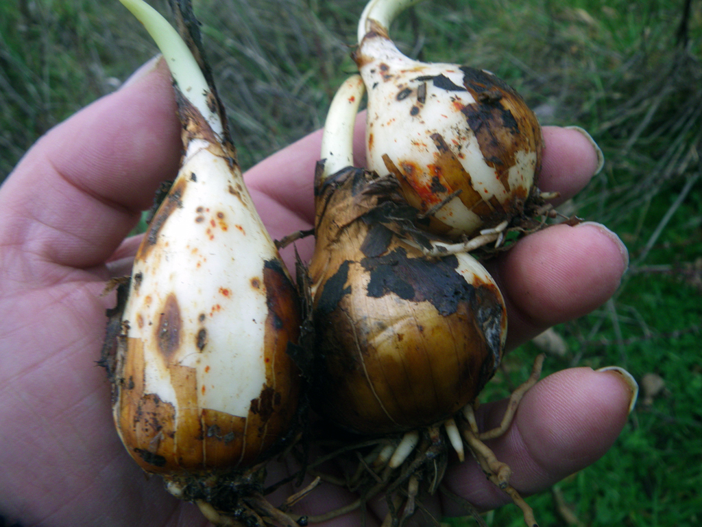
Villages were distributed across the landscape in close enough proximity to allow for easy travel between them and between the lowlands and the mountains. Trade and other exchanges created and maintained a diverse food system. Available resources ranged from the carbohydrate-dense roots and berries cultivated and tended in the upper watershed, to the deer, elk, and smaller mammals that browsed among them, to the fat-rich fish, shellfish, birds, and mammals found in and near the salt water.
Coast Salish people were anchored to permanent winter villages even as they moved around the watershed, gathering, fishing, hunting, tending, and visiting with other groups. Familial relationships determined where people could fish, hunt, or gather. In general, the annual round of travel began in the spring as families moved to prairies where camas bulbs were gathered. In the early summer, berries could be picked and dried in the prairies and shellfish could be gathered and dried on the shore of the Puget Sound.
Fish travelled up into the lakes, rivers, and their tributaries at different times during the season. A large fishing weir stood at the mouth of Ravenna Creek, where salmon swam up to Green Lake. From late spring to late summer, people came together in camps to catch salmon on the rivers and dry or smoke it for later use.
In the fall, people gathered late-ripening huckleberries and hunted elk, deer, bear, mountain goats, and other land animals in the upper elevations. In the cooler months, on Lake Washington near villages such as SWAH-tsu-gweel, people came to harvest wapato (a tuber) in the nearby wetlands. These included Suquamish people, who traveled across Portage Bay to camp, fish, and gather on the shores of the lake. Winter was a time to be inside the large longhouses, where families could prepare food around the large fires, make and repair household items, tell stories, and hold large gatherings and ceremonies.
The seasonal rounds took place in close proximity to water. The word for river in Lushootseed refers to an opening. Rivers were and continue to be alive, demanding respect, and, according to elders, they are thought of as women. Fresh, clean water is integral to Coast Salish spiritual practices, which include cold bathing and sweat lodges.
Canoes were used to travel the waterways and trails in and across the upper watersheds. The uplands occupied a middle ground between coastal groups and plateau peoples from the east side of the Cascade Mountains. Trade and intermarriage strengthened regional trade networks, increased food security, and extended access to resources outside of the watershed.
Tribal Groups of the Watershed
The numerous communities living along the lakeshores and waterways were later grouped into the major tribal groups associated with the watershed today: the Snoqualmie, Duwamish and Muckleshoot, with the Suquamish from the Kitsap Peninsula retaining rights in the watershed they have visited for millennia to maintain relationships and access to the rivers, lakes, and salt marshes not available in their traditional territory.
The Snoqualmie lived in the upper part of the watershed and included the Haht-hah-chu-AHBSH (Second-Lake People) living on the east side of Lake Sammamish. The Tsah-PAHBSH (Meander Dwellers) lived along the Sammamish River. The Hah-chu-AHBSH (Lake People) were somewhat intermediate, with access to the social networks of the coastal saltwater people and the inland Snoqualmie. The Ha-ah-chu-AHBSH (Littlest-Lake People) lived on Lake Union (hah-AH-chu). Those living along the outlet of Lake Washington, on the Cedar, Black, and Duwamish rivers, were collectively referred to as the Doo-AHBSH (Anglicized as Duwamish), or "People of the Inside." The Shill-shohl-AHBSH lived in Salmon Bay at shill-SHOHL (Threading a Needle).
Lake Washington, situated between the Cascades and the saltwater, lies at the center of the flows of water, people, and fish through the watershed. With rivers entering from its north and draining south, it was possible to travel up from Puget Sound through salt and freshwater marshes to the lake's resource-rich wetlands, then continue on to the upper watershed via Lake Sammamish. Trails linked villages, and to the west was an easy portage out through Salmon Bay to the sound. Seasonal activities, gaming, and ceremonies wove together relationships within and across the watershed, extending both across the saltwater to the west and up into the mountain to the east.
Disease, Displacement, and Environmental Damage
Coast Salish values, including reciprocity and an acceptance of outsiders, facilitated early trade with non-Native people in the watershed. But contact also brought epidemics that devastated Coast Salish communities, with mortality rates of more than 80 percent.
Even while families and communities endured massive disruption caused by disease, federal settlement policies and the methods of a market-driven culture were being rapidly introduced into the watershed. The first non-Native settlements were on the prairies and around the lakes, but they soon moved up the Cedar River. Property boundaries were established according to the township system, and a pattern of private ownership was overlaid on the landscape. Millennia of cultural practices based on interrelated reciprocity were now subject to the alien rules of a market economy.
This early economy was based on resource extraction -- forestry, mining, and fishing -- which rapidly began to impact the watersheds. Salmon fishing was concentrated near saltwater shorelines, and the number of fish returning to spawn in the middle and upper watershed diminished. Coal was found on the upper Black River in the 1850s, and a steam-powered sawmill was set up in Seattle in 1853. Steam-powered vessels began operating on the waterways, and river logjams that supported salmon habitat were cleared to ease the boats' passage. A small flume was built near the present-day Montlake Cut in 1886 to float logs from Union Bay and Portage Bay to the Western Mill Company at the south end of Lake Union.
Treaties and Tribes
The Coast Salish people living in the Cedar-Sammamish Watershed signed treaties with Territorial Governor Isaac I. Stevens (1818-1862) that ceded land and established reservations, but reserved to the Native people certain rights. The 1854 Treaty of Medicine Creek affected those living on the upper Green River, who often used the upper Cedar River watershed for subsistence, trading, socializing, and crossing the Cascades. The treaty established a reservation for them and other upriver bands on the Muckleshoot Prairie near today's Auburn. In January 1855, the Treaty of Point Elliott grouped the Duwamish, Suquamish, Snoqualmie, and other Native groups living between the White and Skagit rivers and along the Duwamish River into one Duwamish Tribe. This treaty created the Port Madison Reservation for the Duwamish and Suquamish people.
The growing influx of non-Native people immigrating to the region in the 1860s further displaced Native people and villages and interrupted traditional hunting, gathering, and fishing practices. Some moved to the Muckleshoot Reservation, established by executive order in 1857, and others moved to Port Madison. A number remained around Lake Union and Salmon Bay, but an attempt to establish a reservation for the Duwamish on their traditional lands in the river valley was blocked.
The Snoqualmie were expected to go to the Tulalip Reservation, even though they were not culturally affiliated with saltwater. Many Duwamish people from around Lake Union, Portage Bay, and Lake Washington went to the Muckleshoot Reservation; others went to the Suquamish, Tulalip, or other reservations. Some joined members of the Snoqualmie Tribe, who established settlements in the Snoqualmie River drainage and on Lake Sammamish, where they built a community longhouse and practiced traditional activities into the 1930s. Some Duwamish continued living off-reservation; their descendants established the Duwamish Longhouse in Seattle and continue to seek separate federal recognition.
Between the 1860s and 1890s, as the new settlements around the lakes grew, treaty rights were retained, but Native people were -- if not by law, by practice -- excluded from gathering, hunting, and fishing. Nonetheless, Muckleshoot, Snoqualmie, and Duwamish people continued to live and work in the area.
The Cost of Progress
The growth of Seattle has driven much of the change in the Cedar-Sammamish Watershed. The settlement at Seattle created a local market for farm produce and for coal, timber, and other raw materials that could be harvested and mined in the watershed. The relative ease of traveling on Lake Washington and Lake Sammamish with canoes and scows attracted homesteaders, and valuable logs could be cut from shoreline forests and floated down to Seattle.
Later, railroads and steamers increased access to markets and attracted more settlers. Ferries carried passengers and freight across Lake Washington. Railroads stimulated development of coal mines near Renton and Issaquah, and transport became more reliable and predictable when the Seattle and Walla Walla Railroad began operating along the Duwamish River Valley in the 1870s. In 1883, the Seattle, Lakeshore and Eastern Railroad began operations along the north and east sides of the lake. It carried people, coal, and timber between the foothills and the city.
Real-estate developments and small industry grew up on the north half of Lake Washington, including a tannery at Union Bay, a lumber mill at Kenmore, and a shipyard at Kirkland. From Medina to Bellevue the eastern shore of Lake Washington was dotted with homes and small berry farms.
Beginning in 1901 Seattle tapped the Cedar River for a municipal water-supply system, removing millions of gallons of water per day. A dam at the western end of Cedar Lake held back winter rains and spring snowmelt for summer use.
The pace of logging throughout the watershed accelerated as machinery such as the steam-powered donkey engine made it easier to log the hillsides away from waterways. Natural feedback loops were disrupted because the trees, standing or downed, had provided habitat, structure, and function in the watershed.
Seattle grew exponentially after the discovery of gold in the Yukon Territory in 1897, leading to more ambitious projects. Engineers rerouted the Cedar River into Lake Washington in 1911 to prevent flooding in Renton and to create an industrial waterway. In the 1910s, the Army Corps of Engineers built the Lake Washington Ship Canal to allow ships to pass between Puget Sound, Lake Union, and Lake Washington. When the canal began operation in 1916, Lake Washington was lowered about nine feet, which completely reworked the river system. Lake Washington now drained through the ship canal, and the Black River disappeared. Lake Sammamish's level also fell, and the velocity of the Sammamish River increased, eventually necessitating dredging and straightening.
After the ship canal opened, Salmon Bay and Lake Union were quickly industrialized, but the benefits came at a tremendous cost. The Black River and its salmon runs had disappeared, and over 1,000 acres, or 85 percent, of Lake Washington's wetlands were lost. Some sacred places were blasted with dynamite; others were filled with dredge spoils. The lives of the Muckleshoot and Duwamish people of these rivers and lakes were changed forever.
The loss of 90 percent of the salmon and the nutrients they carried into the watersheds to nourish diverse and abundant life had profound cultural consequences for Native people, for whom the seasonal return of salmon to their traditional lands have been a source of identity and food security for millennia. The destruction of these culturally significant places, combined with exclusion from traditional gathering, hunting, and fishing places and other broken treaty promises, continues to require great sacrifice.
As Seattle's growth exploded during and after World War II, residential development began to accelerate on the east side of the lake, abetted by the opening of the first floating bridge in 1940. New development had dire consequences for the waterways when municipal sewer systems discharged treated and untreated sewage into Lake Washington. Seattle tried to clean up Lake Washington as early as the 1920s, but only the formation of the Municipality of Metropolitan Seattle (METRO) in 1958 and its development of a regional sewage-treatment system began to improve water quality in the basin.
A New and Better Era
By the 1960s the cumulative impacts of over 100 years of intensive resource extraction and industrialization -- water pollution, erosion, declining fish populations, and rapidly disappearing timber stands -- led to a spate of federal laws protecting the environment, including the National Environmental Policy Act and the Clean Water Act. At the same time, Native activists reasserted their treaty-reserved rights to fish, hunt, and gather in their usual and accustomed places. For Native people, then and now, cultural traditions and spiritual beliefs are tied to specific places in the watershed. Their ancestors made many sacrifices in the treaty era to ensure that future generations could have access to traditional foods, medicines, and essential materials. After years of conflict and activism, in 1974 Federal District Court Judge George Boldt (1903-1984) decided United States v. Washington and vindicated the tribes' reserved treaty rights, a ruling that was later sustained by the U.S. Supreme Court.
Since the Boldt Decision, agreements and legislation, particularly the Centennial Accord in 1989, have formalized government-to-government relationships in Washington and provided an avenues for tribal governments to collaborate with state, county, and local governments, and with environmental organizations. Efforts are being made to repair the damage done to the watersheds and shift the values and ideals that decisions are based upon. The 1994 listing of Puget Sound Chinook as an endangered species provided an additional impetus to find viable solutions to conflicts between human activities and watershed health.
The 2006 Muckleshoot Settlement Agreement resolved a conflict between the Muckleshoot Tribe and the city of Seattle over the Cedar River Habitat Conservation Plan, leading to real changes in how the river is managed and ensuring adequate water for fisheries. It reaffirms treaty rights to hunt, fish, and gather in the watershed, and requires co-management of wildlife. If the requirements laid out in the agreement are followed, the whole watershed and everyone living in it will benefit.
Access to resources, a voice in their management and preservation, and the maintenance of water quality in traditional use areas are essential to the preservation of traditional food sovereignty and health for Coast Salish people. The treaties promised that access to these resources would be protected in perpetuity, and great sacrifices were made in exchange for that guarantee. The acknowledged need to meet treaty obligations and a growing recognition of the challenges of climate change have led government agencies to begin to take the interconnectedness of human health, cultural stability, and environmental health into account in planning. Slowly, the short-term emphasis of economics-based development is shifting to an emphasis on long-term ecosystem health.
