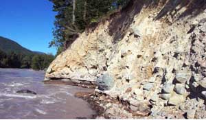
Approximately 5,600 years ago, a massive landslide removes .7 cubic miles of earth from the summit of Mount Rainier. The ensuing mudflow, which spreads as far as modern-day Kent, is called the Osceola Mudflow. This is the largest mudflow of postglacial age in the history of Mount Rainier.
Before the mudflow, the salt waters of Puget Sound covered what would later become the Duwamish and White River Valleys. In some areas, the Duwamish Valley was hundreds of feet deeper than it is today. Aboriginal peoples lived south of the inlet, and up on the surrounding plateaus. Evidence of human encampments near Enumclaw have been found buried under 75 feet of mud.
In approximately 3600 B.C., the summit of Mount Rainier collapsed, most likely due to magma forcing its way into the volcano. The landslide removed the top 2,000 feet, leaving a crater. This sent forth a massive avalanche of rock and mud, traveling faster than 20 feet per second, which destroyed everything in its path. Native American legends allude to this fact. The mudflow shot through canyons and valleys, and over small hills, until the debris reached as far as modern-day Kent.
This left a “mud bump” which covered most of the White River and Puyallup River Valleys. Over the centuries, the White River, which had originally connected with the Puyallup River to the south, slowly carved a new channel northward. This spread the mud and alluvium throughout the valley, and eventually pushed back the waters of Puget Sound to the present boundaries of Elliott Bay.
A smaller mudflow from Mount Rainier, the Electron Mudflow, occurred approximately 500 years ago. This sent mud flowing through the Puyallup valley, but not to the extent of the Osceola Mudflow.

