Re-imagining Seattle Through Maps and Images
Appropriate for grades 4-8
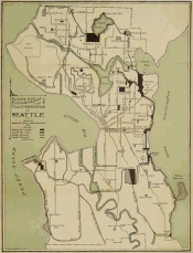
Students will examine the physical and social landscape of Seattle during the fair, then use these as a means to incorporate geography concepts and standards into classroom activities.
Download:
Curriculum
Unit7_Lesson1_MapAnalysisQuestions.pdf
Unit7_Lesson1_PreAssessment.pdf
Unit7_Lesson2_Location.pdf
Unit7_Lesson3_Place_Changing-PerspectiveOfSeattle.pdf
Unit7_Lesson3_Place_CityCountySeals.pdf
Unit7_Lesson3_Place_CitySealsSeattle.pdf
Unit7_Lesson3_Place_HowDidSeattle-GetItsName.pdf
Unit7_Lesson3_Place_Seattle2062Seal.pdf
Unit7_Lesson4_Region.pdf
Unit7_Lesson5_ChangesOverTime.pdf
Unit7_Lesson5_TravelToWork.pdf
Unit7_Lesson6_AnalyzingProsConsO-fManMadeProjects.pdf
Unit7_Lesson6_FinalProject.pdf
Unit7_Lesson6_ImageAnalysis.pdf
PDF Presentations:
Unit7_FinalProject2062SeattleWorldGÇÖsFair.pdf
Unit7_FiveThemesGeography.pdf
Unit7_MovementInAndOutOfSeattle.pdf
Maps:
Unit7_MAP_landuse_1958.jpg
Unit7_MAP_SeattleBusinessDistrict_1903.jpg
Unit7_MAP_SeattleParks_1909.jpg
Unit7_MAP_TerritorialGrowthofSeattle_1891.jpg
Unit7_MAP_WaterRoutes_1937.jpg
Reading:
Unit7_READING_520Controversy-CutsWideSwath.pdf
Unit7_READING_BlackRiverDisappears.pdf
Unit7_READING_ChiefSeattlearticle.pdf
Unit7_READING_ElliotBaySeawall.pd
Unit7_READING_I90FloatingBridge.pdf
Unit7_READING_LakeWashingtonShipCanal.pdf
The Imagine curriculum is a project of The Next Fifty and was made possible with funding from the Seattle Center Foundation and 4Culture. Additional in-kind support was provided by KCTS 9, HistoryLink, The Seattle Times Newspapers In Education, Jack Straw Productions, the National Archives and Records Administration (NARA), the Museum of History & Industry, the Seattle Architectural Foundation, Bellevue Public Schools, Seattle Public Schools, and the Edmonds School District.
 |
 |
 |
 |
